Seaside Vancouver bike route
49°16′ N 123°07′ W25 km · 52 m upModerateCity bike, Gravel bike
The Seaside Vancouver bike route is the City of Vancouver's loop from Olympic Village along the south shore of False Creek and past Kitsilano to Spanish Banks, then back over the Burrard Bridge and around the north side of False Creek, and it suits riders who want Vancouver's beaches and skyline on separated paths; the City rates it Medium and warns of gravel paths and short climbs.
Photo by Amy Tran on Unsplash and others, credited in the gallery
Field card · Route · No. 005 · checked 16 Oct 2026
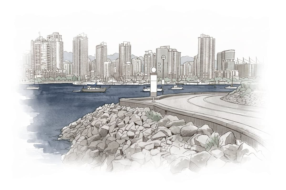

ModerateLoopCity bike, Gravel bike
ShopsDrinking waterToiletsBike shopsTop of chart 50 m
Routed over OpenStreetMap with OSRM bike (FOSSGIS) and measured against Mapterhorn z15 on 2026-10-17. The waypoints run clockwise. 2.1 km crosses bridges or water, where the elevation is drawn straight across. BRouter was not available for this build, so the surface and traffic mixes wait for the next one.
On the road
- Surface
- The City says the route follows separated bike paths for the most part and includes gravel and unpaved stretches. OpenStreetMap maps the Seaside Greenway from Jericho Beach out to Spanish Banks as compacted gravel, with a gravel stretch in Vanier Park.
- Traffic
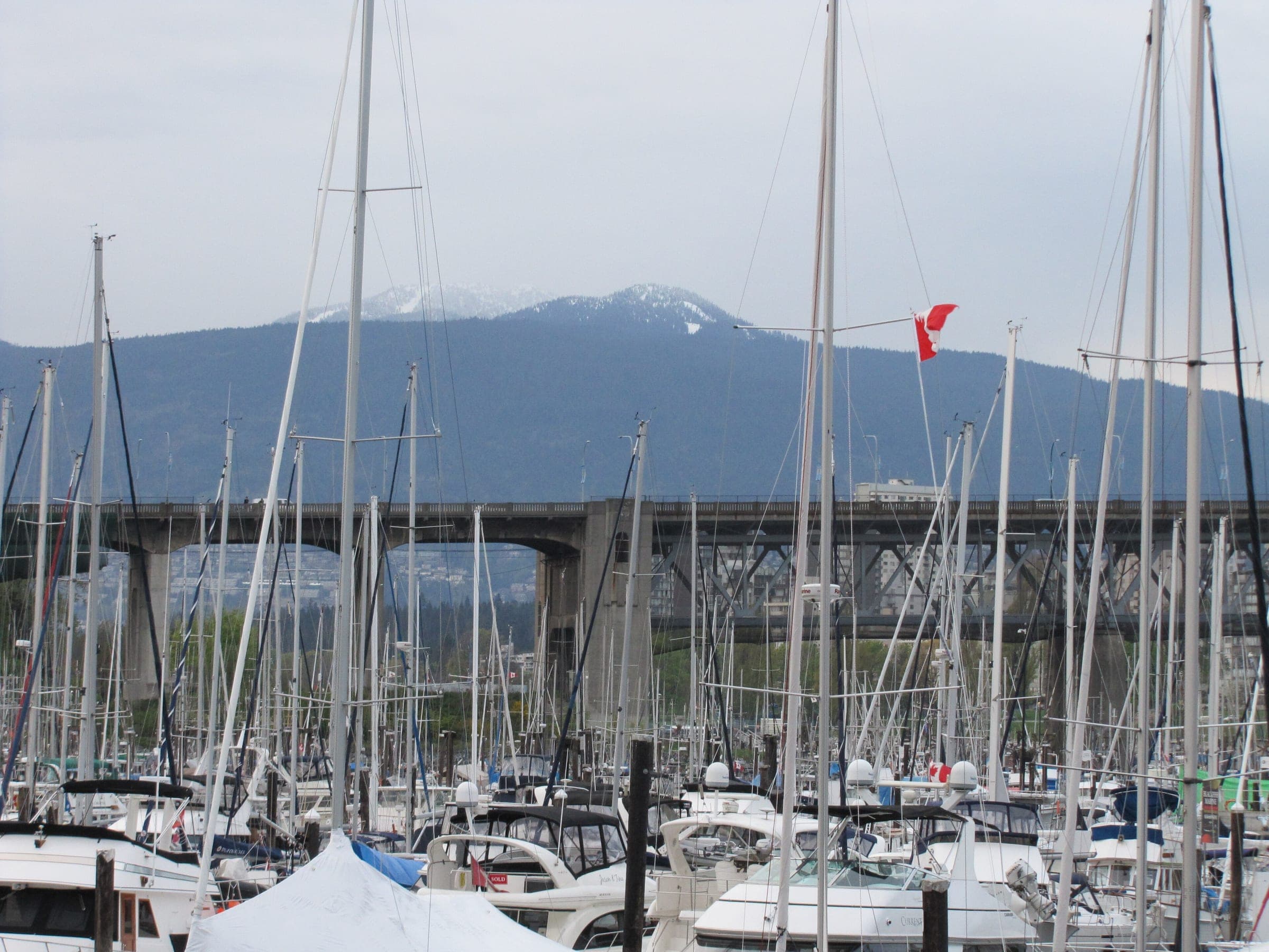
- Most of the loop runs on the Seaside Greenway's separated paths. The way back uses the York Bikeway and the bike lanes over the Burrard Bridge before it rejoins the seawall on the north side of False Creek.
- Start
- Olympic Village Station. The City's route starts at the Canada Line's Olympic Village Station, and TransLink allows one bike per Canada Line car at all times.
- Getting there
- Canada Line, Aquabus, Mobi bike share
Ride safely
- The City warns of steep sections on the seawall around Kitsilano and Point Grey, and on the climb onto the Burrard Bridge.
- The gravel out to Spanish Banks suits wider tires, so leave the narrow road tires for another day.
Where to stop
Stops along the way
Granville IslandLunch
The route passes Granville Island early on, and the Public Market is indoors for a wet day.
KitsilanoCoffee
The new separated path through Kitsilano Beach Park links Balsam Street and McNicoll Avenue.
Jericho BeachSwim
The City marks Jericho Beach on its route map.
Spanish Banks ViewpointView
The City's route turns round at the viewpoint at the west end of Spanish Banks.
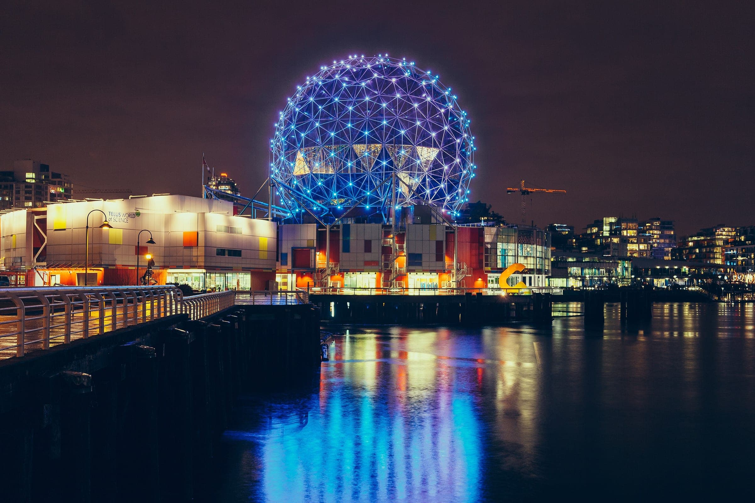
Science WorldSight
Science World stands at the east end of False Creek, just before the loop closes.
Every stop OpenStreetMap lists along the line (127): bike rental, bike shops, drinking water, shops, cafés
- Olympic Village StationBike rentalkm 0
- 7th & AshBike rentalkm 0
- Bike shopsBike shopskm 0
- Yukon & 6thBike rentalkm 0.1
- Wylie & 2ndBike rentalkm 0.2
- Stamps LandingBike rentalkm 0.4
- Spyglass & SeawallBike rentalkm 0.6
- Drinking waterDrinking waterkm 1.6
- Drinking waterDrinking waterkm 1.7
- Charleson ParkBike rentalkm 1.8
- 7th & AlderBike rentalkm 2.1
- Drinking waterDrinking waterkm 2.3
- Dean's Food StoreShopskm 2.4
- Drinking waterDrinking waterkm 2.5
- Granville IslandBike rentalkm 2.5
- My Island CafeCaféskm 2.6
- Anderson & 2ndBike rentalkm 2.6
- Tru CafeCaféskm 2.7
- Drinking waterDrinking waterkm 3.4
- Vanier ParkBike rentalkm 3.6
- Chestnut & McNicollBike rentalkm 4.4
- McNicoll & ArbutusBike rentalkm 4.7
- Drinking waterDrinking waterkm 5
- Drinking waterDrinking waterkm 5.1
- Kitsilano Beach ParkBike rentalkm 5.2
- KITS Cafe & EyewearCaféskm 5.3
- York & YewBike rentalkm 5.4
- Drinking waterDrinking waterkm 5.5
- Kitsilano Beach CafeCaféskm 5.5
- Balsam & CornwallBike rentalkm 5.7
- Trafalgar & CornwallBike rentalkm 6.2
- Drinking waterDrinking waterkm 6.4
- Drinking waterDrinking waterkm 6.6
- Point Grey & BayswaterBike rentalkm 6.7
- Point Grey & BlenheimBike rentalkm 7.1
- Drinking waterDrinking waterkm 7.3
- Alma & Point GreyBike rentalkm 7.7
- Jericho Beach ConcessionCaféskm 8.2
- Drinking waterDrinking waterkm 8.2
- Jericho BeachBike rentalkm 8.2
- Drinking waterDrinking waterkm 9.4
- Drinking waterDrinking waterkm 9.5
- Spanish Banks EastBike rentalkm 10.2
- Drinking waterDrinking waterkm 10.7
- Drinking waterDrinking waterkm 11
- Drinking waterDrinking waterkm 12.2
- Drinking waterDrinking waterkm 12.5
- Spanish Banks EastBike rentalkm 13.1
- Drinking waterDrinking waterkm 13.7
- Drinking waterDrinking waterkm 13.8
- Drinking waterDrinking waterkm 14.9
- Jericho Beach ConcessionCaféskm 15
- Jericho BeachBike rentalkm 15
- Alma & Point GreyBike rentalkm 15.4
- Drinking waterDrinking waterkm 15.9
- Point Grey & BlenheimBike rentalkm 16
- Point Grey & BayswaterBike rentalkm 16.5
- Drinking waterDrinking waterkm 16.6
- Drinking waterDrinking waterkm 16.8
- Trafalgar & CornwallBike rentalkm 17
- Balsam & CornwallBike rentalkm 17.4
- York & YewBike rentalkm 17.7
- Viva Cafe & BakeryCaféskm 17.7
- Enroute Cycling & CafeCaféskm 17.7
- Enroute Cycling & CafeShopskm 17.7
- Kitsilano Beach ParkBike rentalkm 17.8
- Circle KShopskm 18.1
- Panne RizoCaféskm 18.2
- Pane From HeavenCaféskm 18.3
- Central Gourmet MarketShopskm 18.3
- Cypress & CornwallBike rentalkm 18.3
- Drinking waterDrinking waterkm 18.4
- Bishop's Family CyclesShopskm 18.4
- 1st & ChestnutBike rentalkm 18.4
- LimeBike rentalkm 18.7
- Vanier ParkBike rentalkm 18.9
- Drinking waterDrinking waterkm 19.1
- The GrindCaféskm 19.4
- Bicycle Sports PacificShopskm 19.6
- Puzzle E RideShopskm 19.6
- Burrard & DrakeBike rentalkm 19.6
- Hornby & DrakeBike rentalkm 19.7
- Granville & NeonBike rentalkm 19.7
- Pacific & RolstonBike rentalkm 19.7
- Beach & HornbyBike rentalkm 19.8
- Rolston & GranvilleBike rentalkm 19.8
- inBtwn CafeCaféskm 19.9
- Easy Day StoreShopskm 19.9
- Drinking waterDrinking waterkm 20.2
- Beach & SeymourBike rentalkm 20.2
- Drinking waterDrinking waterkm 20.4
- David Lam ParkBike rentalkm 20.8
- Drinking waterDrinking waterkm 20.9
- Pacific & RichardsBike rentalkm 20.9
- Reckless The Bike StoreShopskm 21.5
- Cafe ArtigianoCaféskm 21.5
- Yaletown ExpressShopskm 21.5
- Yaletown-Roundhouse StationBike rentalkm 21.5
- Marinaside & DavieBike rentalkm 21.6
- Small VictoryCaféskm 21.6
- Spyglass & SeawallBike rentalkm 21.9
- Drinking waterDrinking waterkm 22
- Marinaside & CooperageBike rentalkm 22
- Bike shopsBike shopskm 22.5
- Carrall & SeawallBike rentalkm 22.7
- Expo & CarrallBike rentalkm 22.7
- Creekside Park NorthBike rentalkm 23
- Drinking waterDrinking waterkm 23.1
- Science WorldBike rentalkm 23.2
- Tim HortonsCaféskm 23.2
- Main Food StoreShopskm 23.2
- Quebec & 1stBike rentalkm 23.4
- Ontario & SeawallBike rentalkm 23.5
- Drinking waterDrinking waterkm 23.6
- Drinking waterDrinking waterkm 23.6
- Terra BreadsCaféskm 23.7
- Drinking waterDrinking waterkm 23.7
- 1st & ManitobaBike rentalkm 23.7
- Columbia & 1stBike rentalkm 23.8
- Drinking waterDrinking waterkm 23.9
- Spyglass & SeawallBike rentalkm 24.4
- Stamps LandingBike rentalkm 24.7
- Wylie & 2ndBike rentalkm 24.8
- Yukon & 6thBike rentalkm 24.9
- Olympic Village StationBike rentalkm 25
- 7th & AshBike rentalkm 25
- Bike shopsBike shopskm 25
From OpenStreetMap, within each kind’s reach of the line. Opening hours change; check before you rely on one.
The City of Vancouver publishes this loop as one of its featured bike routes and starts it at Olympic Village Station on the south shore of False Creek. It runs west past Granville Island and Vanier Park and crosses Kitsilano Beach Park on the separated path between Balsam Street and McNicoll Avenue. Point Grey Road then leads to the beaches at Jericho and Locarno, and the far end is the Spanish Banks viewpoint. From there you ride back east and turn up York Avenue to the Burrard Bridge. The seawall on the north side of False Creek carries you round past Science World to the start.
The City times the loop at 2 hours 30 minutes of riding at 12 km/h and suggests adding up to an hour for stops. It rates the route Medium, and it warns of gravel paths and of short steep sections on the seawall around Kitsilano and Point Grey and onto the Burrard Bridge. The Canada Line takes one bike per car at all hours, so Olympic Village Station works as both start and finish for anyone staying downtown or out by the airport.
Worth knowing
- The Aquabus takes bikes on its platform boats if you want to cut the loop short across False Creek.
- Bring a lock for Granville Island, where the Public Market makes an indoor stop on a wet day.

Quick answers about Seaside Vancouver bike route
How long does the Seaside Vancouver bike route take?
About 2 hours 30 minutes of riding, by the City of Vancouver's estimate at 12 km/h. The City suggests adding up to an hour for stops along the Seaside Vancouver bike route.
Is the Seaside Vancouver bike route paved?
Mostly. The City of Vancouver says the Seaside Vancouver bike route follows separated bike paths for the most part and includes some gravel and unpaved paths.
Can you take a bike on the Canada Line to Olympic Village?
Yes. TransLink allows one bike per Canada Line car at all times, so you can ride the train to Olympic Village Station, where the City's route starts.
Where can you buy food and water on the Seaside Vancouver bike route ride?
OpenStreetMap lists shops at 11 points within reach of the Seaside Vancouver bike route line, and drinking water at 26. The longest stretch without shops is 15.3 km, so carry what you need for it.
Within 8 km
Places to stay nearby


Within 8 km
Places to eat and drink nearby

Within 8 km